
Illustrated Map of the Philippines (3 sizes)
$25.00 - $50.00


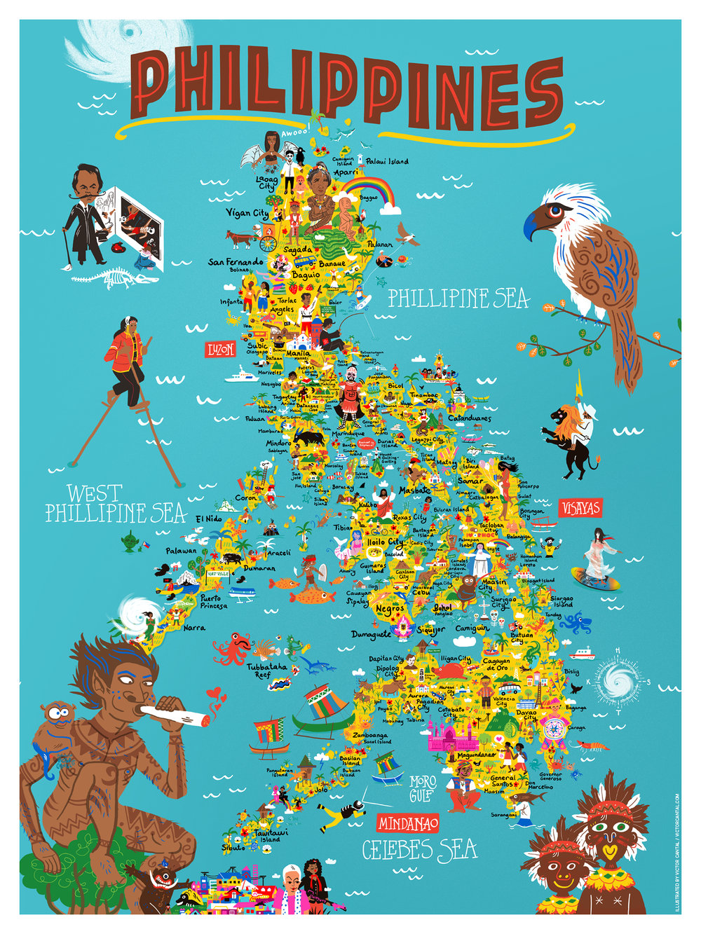
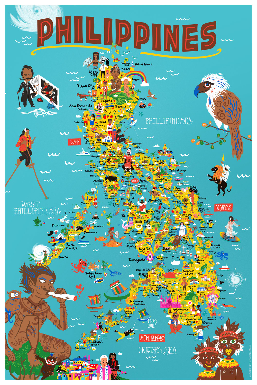
A fun map featuring unique details of the different parts of the Philippines. A wonderful way for people to (re)connect to the country. Unlike any traditional map where the purpose is direction, this one takes the viewer to an emotional journey around the archipelago. A kind of trip marked by local stories, myths, traditions, food, and to some, nostalgia. Original illustration by Victor Cantal.
The map is printed on museum-quality poster on thick and durable matte paper. Rolled in sturdy cardboard tube.
• Paper thickness: 10.3 mil
• Paper weight: 5.57 oz/y² (189 g/m²)
• Giclée printing quality
• Opacity: 94%
• ISO brightness: 104%